
California Council of Land Trusts is partnering with TerrAvion to offer members special access to historical and up-to-date imagery at a special discounted price.
TerrAvion is a remote sensing and aerial imagery company that provides on-demand, high-resolution multispectral imaging, and environmental data services captured by manned aircraft. Their mission is to bring transparency and provide the stewardship, conservation management, and agricultural communities aerial imagery tools to better manage resources, track the effects of management decisions, and optimize yields.
The cost is low and you don’t need your own GIS system or technician to utilize the services. Their online system can be used to view and host all of your data. It is a great opportunity for smaller land trusts to gather new data on their properties and larger land trusts to better monitor large tracts of land.
How to get started:
- Contact Fred at TerrAvion and let them know you’re a member in good standing with California Council of Land Trusts.[email protected]
- Create a shape file for the areas you want to receive data on. Here’s how!
TerrAvion provides the following types of imagery:
- Natural Color (NC)
- Color Infrared (CIR)
- Normalized difference vegetation index (NDVI)
- Zoning (Zoned NDVI Image)
- Thermal (Thermal InfraredImage)
While this video focuses on TerrAvion’s agricultural applications it provides a good overview of its applications.
Several land trusts that have already utilized TerrAvion’s services in the past including:
- Big Sur Land Trust
- Center for Natural Lands Management
- Sempervirens Fund
- Solano Land Trust
Land Trusts have used imagery to:
- Add up-to-date imagery to baseline document reports
- Create vegetative and habitat maps
- Respond to trespassing and other unauthorized uses
- Compare land conditions across seasons
- And new cases are currently being developed

Aerial imagery allowed this land trust to determine when and where an unauthorized vehicle accessed their property so they were able to determine a procedure for preventing future trespass.
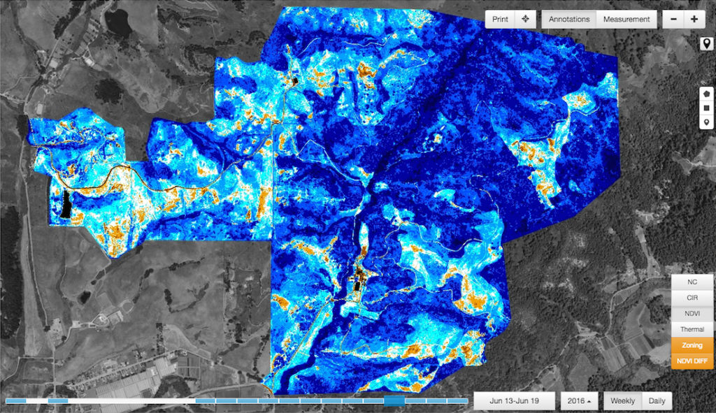
Normalized difference vegetation index (NDVI) imagery can help land trusts assess the health of the vegetation on their properties.